|
Cultural and natural areas
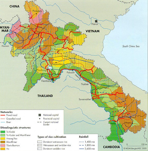
There is a
correlation between the distribution of ethno-linguistic and agro-ecological structures, with wet-season
rice
dominant in the Mekong Valley populated by the Tai-Kadai, and swidden
rice (ray) dominant in the highlands
of
the North and South populated by Austro-Asiatics.
Relief
explains certain overlaps, such as wet-season rice
in
the Austro-Asiatic
area of settlement on Savannakhet
Plain.
This map suggests a way to
organize the territorial
entities
in the northern part of the country. The entire
province
of Xayabury,
with a combination of wet-season rice and swidden
rice and a Tai-Kadai
population, is
clearly
distinct from the central block of the North and
bears more
resemblance to Vientiane province. This same
combination,
with the addition of Hmong
people,
characterizes the two provinces of the North-East, which
are
completely differentiated from the central block of
the
North and are also attached to Vientiane province.
The
same agro-ecological combination linked with
Tibeto-Burmans
and Ho
also distinguishes
the
peripheries
to the north and north-west of this central
block.
|